|
|
|
|
|
|
|
|
|
Why Settle for Just One Map? |
- The PN-Series has the amazing ability to layer multiple
map and imagery types on the included Topo North America
terrain and street detail.
- Whatever your preferred activity, you'll never have to
settle for just one map.
- Find your position on up-to-date DeLorme Topo
North America maps.
- Navigate worry-free with complete U.S. and Canada
topographic detail
- Extensive U.S. trail coverage
- U.S. & Canada streets, roads, and places of interest
like campgrounds, boat launch sites, unique natural
features, prime hunting and fishing spots
- A $40 Sample Certificate is
included for downloading sample supplementary datasets. Take
a "test drive" with any of the supplementary datasets
DeLorme offers: high-resolution aerial imagery, USGS and
Canada topographic quads, and NOAA Nautical charts.
- Download:
DeLorme Topo North America regional maps.
|
|
|
|
|
|
DeLorme Map Library |
 |
 |
 |
 |
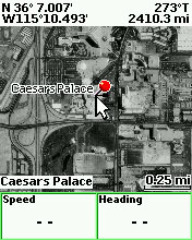
| Color Aerial
Imagery |
USGS Quad |
NOAA
Nautical Chart |
Canadian
Topo |
|
- For more variety and detail, a low cost subscription to
the unique DeLorme Map Library entitles you to unlimited
amounts of:
- High-Resolution U.S. color aerial imagery
- USGS 1:24,000 topographic quads
- NOAA nautical charts
- 1:50,000 Natural Resources Canada topographic map sheets
|
|
|
|
|
|
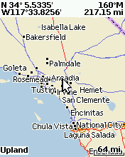
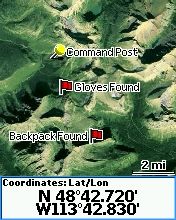
DeLorme World Base Reference
Map |
|
|
- Preloaded on the Earthmate GPS PN-Series
- High-level map includes country borders, highways &
major roads
- Displays interstates and major highways at scales of 500
miles to 8 miles
- Created by DeLorme’s staff of professional cartographers
|
|
|
|
|
|
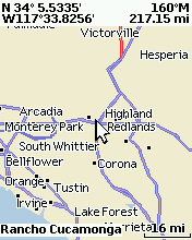
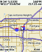
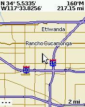
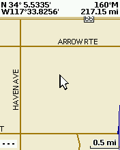
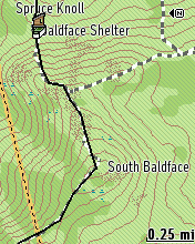
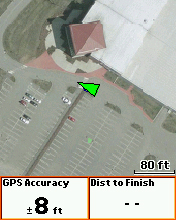
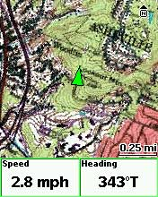
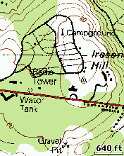
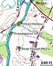
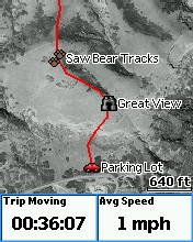
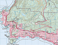
Detailed U.S. Street &
Topographic Maps |
|
|
- Cut & transfer custom map packages of the exact coverage
you want
- Detailed vector-based maps created from the USGS
topographic data & the latest DeLorme U.S. street & trail
network
- U.S. land cover including bodies of water, wetlands,
forests, mountains, glaciers, grasslands, rock cover & more
- Contour lines with elevation numbers
- Fully routable when combined with the corresponding
Regional Highway map
- By default, saved map packages include data zoom levels
8-17 (which translates to a scale of 4 miles through 40 ft)
- Saved maps display all roads, land cover, and contours
|
|
|
|
|
|
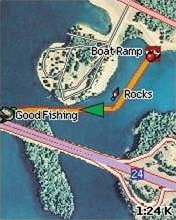
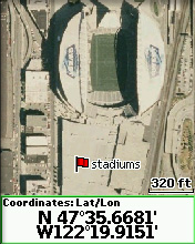
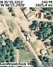
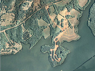
High-Resolution Color Aerial
Imagery |
|
|
- Available for many U.S. States and select U.S. Cities
- Detailed, color, aerial imagery
- Provide a unique aerial perspective, ideal in
off-the-beaten-path environments
- Show roads, trails, buildings, large natural landmarks &
other unique features
|
|
|
|
|
|
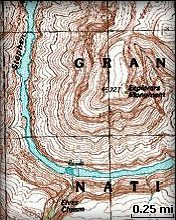
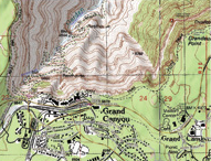
USGS 7.5-Minute Quad Maps |
|
|
- FREE download into Topo USA as part of your ADPs (Aerial
Data Packet)
- Transfer from Topo USA to your PN-Series, only as needed
- The authentic scanned USGS 7.5-minute paper quad maps
- Show roads, trails, buildings, large natural landmarks &
other unique features
|
|
|
|
|
|
Sat-10 Color Satellite
Imagery |
|
|
- FREE download into Topo USA as part of your ADPs (Aerial
Data Packet)
- Transfer from Topo USA to your PN-Series, only as needed
- 10-meter colorized satellite imagery for viewing large
geographic areas
- Provides high-level views of vegetation, topography, and
large, visible geologic formations on the Earth’s surface
- Natural color satellite imagery derived from merging
SPOT 10m panchromatic & Landsat 30m multi-spectral scenes
|
|
|
|
|
|
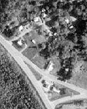
B&W DOQQ (Digital Orthophoto
Quarter Quadrangle)
Aerial Imagery |
|
|
- FREE download into Topo USA as part of your ADPs (Aerial
Data Packet)
- Transfer from Topo USA to your PN-Series, only as needed
- Detailed, black & white, aerial imagery
- Provide a unique aerial perspective, ideal in
off-the-beaten-path environments
- View logging & 4WD roads, bodies of water, and other
natural features from above
|
|
|
|
|
|
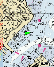
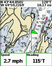
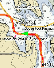
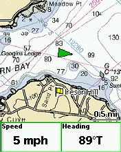
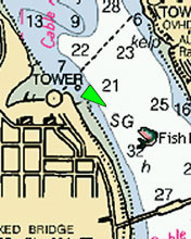
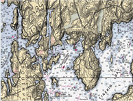
NOAA Nautical Charts |
|
|
- The complete set of U.S. waterway available, including
the Great Lakes, Alaska, and Hawaii
- Include numerous aids to navigation, water depths, water
body names, hazards, and more
- Great for taking along on boating trips, island
explorations, and trips ashore
|
|
|
|
|
|
|
|
|