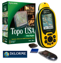
YARMOUTH, ME — November 06, 2007 — The high-sensitivity Earthmate GPS PN-20, a unique all-in-one handheld GPS from DeLorme with market-leading map and aerial imagery offerings, now delivers even more navigation options for use both on land and on the water.
With the newly-released DeLorme Topo USA 7.0 software included, PN-20 users will also discover improved geo-caching support, streamlined GPS data exchanges, the most up-to-date DeLorme street, road, and location detail, and many other exciting features.
Unrivaled Map, Chart, and Imagery Options
Among available handheld GPS receivers, the bright-color-screen Earthmate GPS PN-20 offers by far the most comprehensive and useful selection of available map and imagery choices.
In addition to the full U.S. map coverage of Topo USA 7.0, users can acquire the following datasets for locations of their choice: USGS 1:24,000 (7.5-minute) quads, NOAA nautical charts for coastal waters, the Great Lakes, and numerous inland harbors (e.g., Philadelphia and Seattle); recent color aerial imagery, USGS high-resolution imagery for 133 urban areas; USGS black-and-white aerial, and 10-meter color satellite imagery.
A certificate for $100 in Data Download Dollars comes with each PN-20 sold. Coverage and pricing vary by dataset but, as an example, the $100 certificate would purchase 386 sq. mi. worth of USGS quad maps—an area over 16 times the size of Manhattan Island.
Full Descriptions and Hints for Geocachers
For geocachers, .gpx files can now be imported into Topo USA 7.0 with full descriptions and hints intact. Users importing .loc files into Topo USA 7.0 can copy and paste the descriptions and hints from geocaching.com into the available comments field, also with no character count restriction. The PN-20 does have a character limit, but users can easily edit the comments and hints to fit prior to sending the waypoint to the device.
Streamlined Map Data Exchanges
Map data exchanges are now more efficient. In addition to the Topo USA 7.0 program/data DVD, the PN-20 package contains three DVDs covering the entire U.S. with pre-cut Topo USA 7.0 map sections. The desired sections can be easily sent to an SD-card (a 1GB SD card and reader are included in any PN-20 package sold by authorized resellers). No more time-consuming individual map selection and uploads are required. Just choose the pre-cut map sections for the areas you're most likely to visit, send them to your SD card, and you're done.
4 Million Places of Interest
The included Topo USA 7.0 software also includes over 4 million places of interest—restaurants, lodgings, attractions, businesses of all kinds, and much more—taken from DeLorme's popular Street Atlas USA 2008 software.
In addition, more than 40,000 locations from the DeLorme Atlas & Gazetteer series of state topographic map books now show up in Topo USA 7.0, among them boat launch sites, campgrounds, unique natural features, and prime hunting and fishing spots. All the places of interest and Atlas & Gazetteer locations show up on the PN-20.
Photo GeoTagging, New Online Community, and Support for Popular Wrist Computers
By simply collecting a related GPS track, PN-20 users will now be able to pinpoint the exact GPS location where they took digital photos. This GeoTagging feature is ideal for professional photographers, and a great way for anyone to better preserve the memories of their trips.
Also new is the addition of routing selection to provide estimated time for bicycling trips (in addition to driving and hiking); and, access to the new eartha.com online community, for sharing photos, GPS files, and more with like-minded individuals.
In addition, Topo USA 7.0 also provides support for wrist computers from GARMIN, Timex and Suunto, making it possible to display gathered athletic performance data and display within the Profile map readout of Topo USA. Heart rate data can be seen plotted within the Profile readout, correlated to elevation changes along a running or biking route.
The 12-channel Earthmate GPS PN-20 is WAAS-enabled, NMEA-compliant, waterproof to IPX-7 standards, and comes in a rugged rubberized housing. It has a 220 x 176 transflective TFT color screen (2.2" diameter), 75 MB of onboard flash memory, and an SD card slot for up to an additional 2 GB of storage. It is available at better retail stores and online sites and can also be ordered direct from DeLorme.
About DeLorme
DeLorme is the longtime leader in innovative mapping and GPS solutions for both consumer and professional markets. The company's trailblazing Street Atlas USA and Topo USA consumer software have set the standards for GPS, routing, and travel planning capabilities and utilize the DeLorme-produced mapping databases, developed by DeLorme and not licensed from third parties. DeLorme XMap software is expanding the GIS market through its advanced capabilities, affordable pricing, and ease of use. The company's Earthmate receivers pioneered the concept of GPS for laptop PCs and PDAs. Today, the innovation continues with the Earthmate GPS PN-20 handheld receiver, the Earthmate GPS BT-20 with dual Bluetooth and USB connectivity, and the DeLorme GPS2056 Receiver Module for OEM electronic systems. Located in Yarmouth, Maine, DeLorme is home to Eartha, the world's largest rotating globe.