"The GPSMAP 76 family has long been a favorite of boaters – whether as a primary navigator on small boats, or an ideal backup on larger watercraft," said Gary Kelley, Garmin’s director of marketing. "The GPSMAP 76C and 76CS represent a leap forward with easy-to-read color displays and features that make navigation easier."
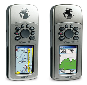
Both units feature a beautiful, high resolution, highly reflective 256-color TFT display and LED backlight — so mariners can navigate in broad daylight or complete darkness. The units will keep the overall sleek and easy-to-use design of earlier generations of the GPSMAP 76 family — including a rugged and waterproof housing that floats.
With the new GPSMAP 76C and 76CS, it’s what’s inside that’s also new. The units boast a 13MB Americas marine basemap, including tide data. In addition, a whopping 115MB of internal memory is available for users to load with optional MapSource BlueChart or Recreational Lakes with Fishing Hot Spots marine cartography. The award-winning BlueChart features depth contours, inter-tidal zones, wrecks, and navaids — while Recreational Lakes includes fishing areas, boat ramps, marinas, and hazards for more than 1,000 popular U.S. and Canadian lakes.
Boaters can rely on the GPSMAP 76C and 76CS when they’re navigating the highways and byways as well — thanks to a built-in, auto-routing basemap of major interstates and highways. When loaded with the optional MapSource City Select detailed street cartography, the units provide automatic route calculation to millions of addresses or points of interest, complete with turn-by-turn directions and tone alerts. The units are also compatible with MapSource U.S. Topo and 24K Topo for off-road excursions.
Loading charts or maps is faster, too — thanks to a reliable USB connection. Navigation instructions can be shared with repeaters, plotters, and autopilots using NMEA protocols through the dedicated serial port as well.
The GPSMAP 76CS also includes an electronic compass and barometric altimeter with an elevation computer that provides current elevation; ascent/descent rate; minimum/maximum elevation; total ascent/descent; and average/maximum ascent/descent rate.
Other specifications for the GPSMAP 76C and 76CS include:
- Display: 1.2"W x 2.2"H, 256-color TFT (160 x 240 pixels) with LED backlight
- Unit dimensions: 6.2"H x 2.7"W x 1.4"D
- Battery life using two AA alkaline batteries: up to 30 hours for GPSMAP 76C; 20 hours typical use for GPSMAP 76CS
- Built-in quad helix antenna with remote antenna capability
- 1,000 user waypoints with name and graphic symbol; 50 reversible routes
- 10,000 point automatic track log; 20 saved tracks let you retrace your path in both directions
- Audible alarms for anchor drag, arrival, off-course, proximity waypoint and clock
- Trip computer provides odometer, stopped time, moving average, overall average, total time, max speed and more
- Waterproof to IEC 60529 IPX-7 standards (submersible to one meter for up to 30 minutes)
- Sensors (GPSMAP 76CS only) include electronic compass (displays accurate heading while standing still), and barometric sensor with automatic pressure trend recording
Standard accessories for the GPSMAP 76C and 76CS include a PC-USB interface cable, Trip and Waypoint Manager CD-ROM, lanyard, owner’s manual, and a quick start guide. The GPSMAP 76C is expected to be available in April 2004 at a manufacturer's suggested retail price of $535.70. The GPSMAP 76CS is expected to be available in June 2004 at a manufacturer’s suggested retail price of $589.27.