Garmin launches Outdoor Maps+ premium map
subscription service
Tuesday, 8 November 2022, 6:00 am CST
#Garmin #Maps #OutdoorMaps+ #Montana700 #Montana700i #Montana750i
Garmin published Montana 7x0 firmware version 14.80 on
Tuesday, November 8, 2022, unofficially making it the first Garmin Outdoor
Handheld product to support their new Outdoor Maps+ premium map subscription
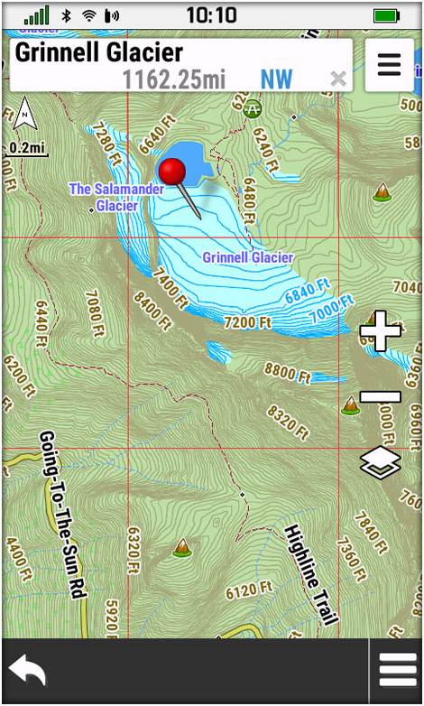
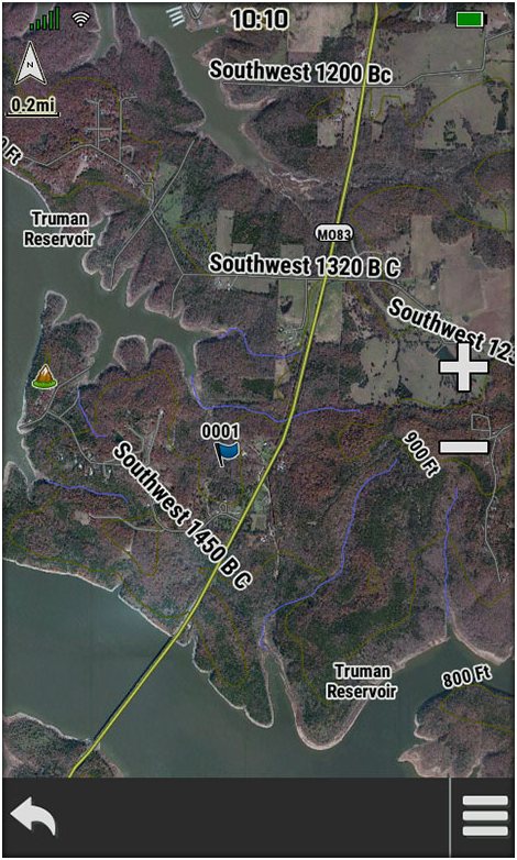
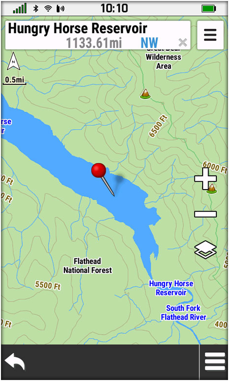
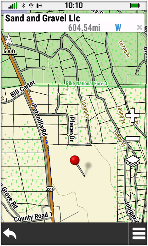
service. With Outdoor Maps+, you have access to a wide variety of premium
mapping content that is regularly updated and delivered directly to your
compatible Garmin device via Wi-Fi connectivity. This premium map data is
collected from multiple sources, providing full coverage of all 50 U.S. states.
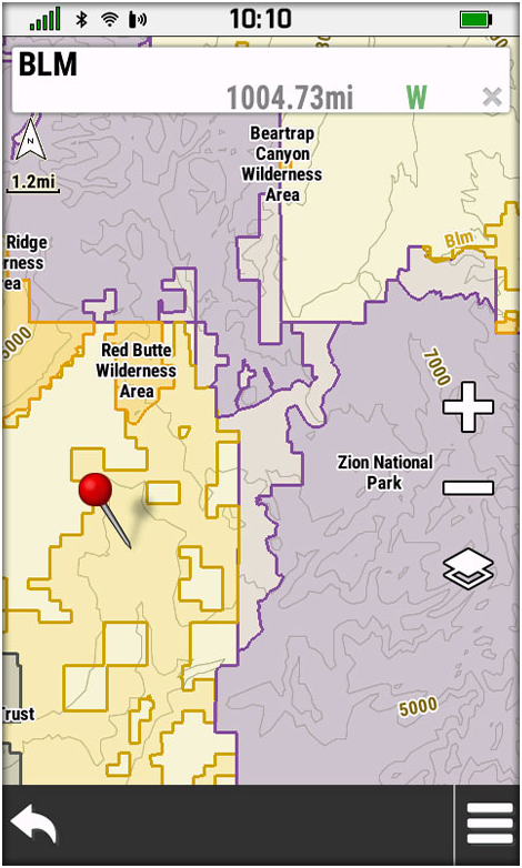
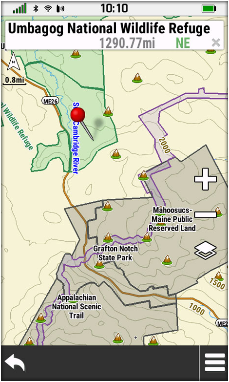
The full collection includes premium elevation contours as well as landowner
names and boundaries for public/private land types and boundaries (Bureau of
Land Management, national wildlife refuges, national parks, state parks,
wildlife management areas) and more.
- Easily download a full suite of premium mapping data via Wi-Fi directly to one device.
- A 1-year subscription gives you full access to regularly updated content for all 50 U.S. states.
- The plan can only be used by one compatible Garmin device but can be transferred to other Garmin devices.
 |
 |
 |
| ENHANCED TOPO MAPS |
SATELLITE IMAGERY |
FRESHWATER FEATURES |
| Get best-in-class elevation mapping with premium
contours for maximum detail. |
Download photorealistic maps directly to your
device, and see a high-resolution perspective from above. Easily find
game trails, locate field edges, discover watering holes and more. |
See detailed mapping of inland lake, river and
stream features. |
| |
|
|
 |
 |
 |
| STATE PLAT MAPS |
LAND MANAGEMENT |
PUBLIC LAND MAPS |
| See how tracts of land are divided into lots
nationwide - with parcel boundaries and landowner names. |
Get up-to-date details on Bureau of Land
Management townships. |
Respect private landowners and view public land
boundaries to know what you’re venturing into. |
| |
|
|
 |
 |
 |
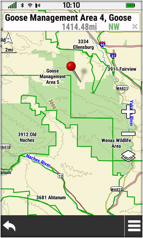
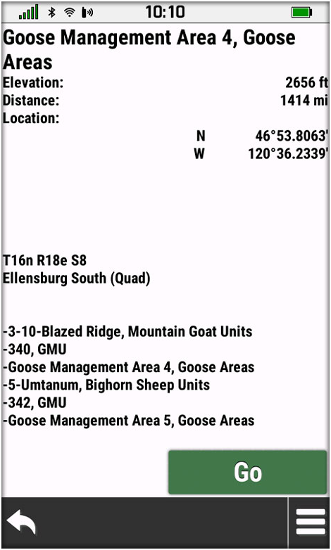
| HUNTING UNITS |
QUAD NAMES |
Outdoor Maps+ Subscription |
| See hunting management unit boundaries for
multiple species (where applicable). |
Provides USGS quad names as well as range and
section information. |
010-D2098-00 |
