 |
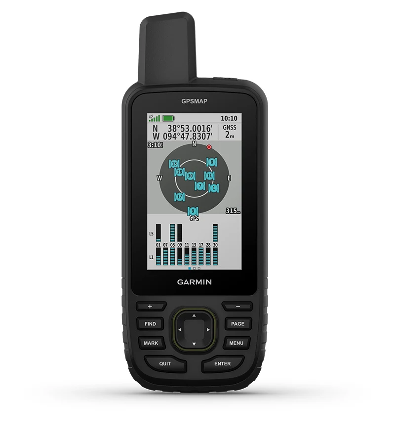
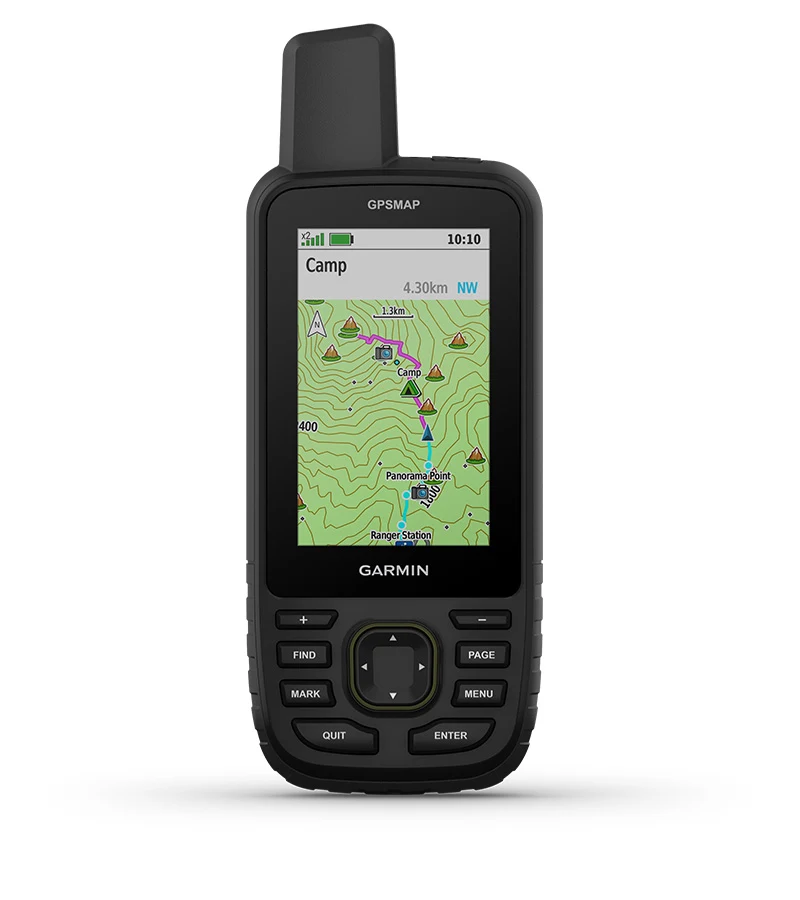
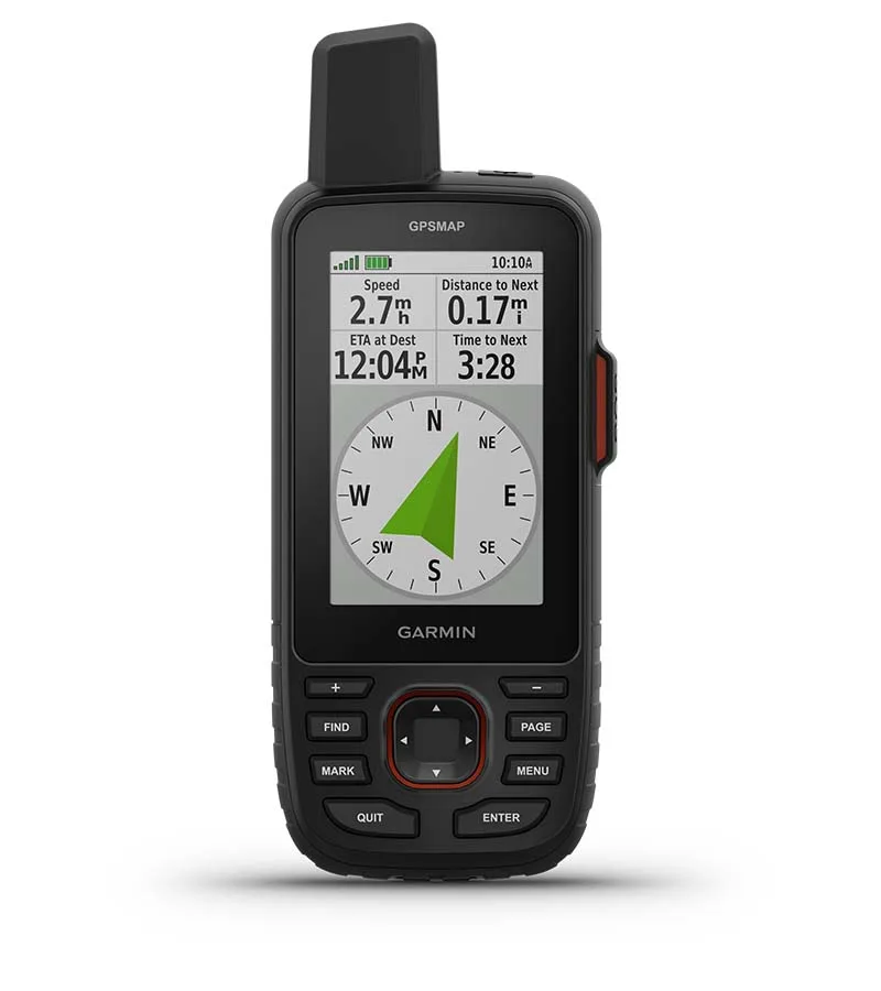
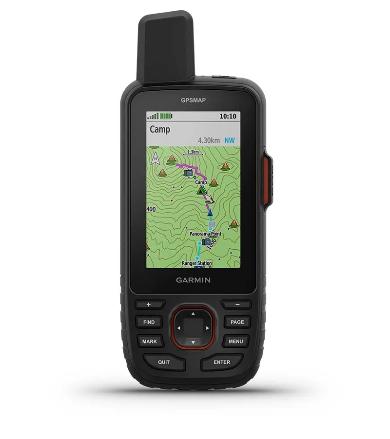
See your route clearly on the 3” sunlight-readable color display. |
 |
Travel longer with up to 180 hours of battery life in GPS mode and up to 840 hours in expedition mode. | |
 |
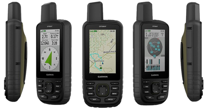
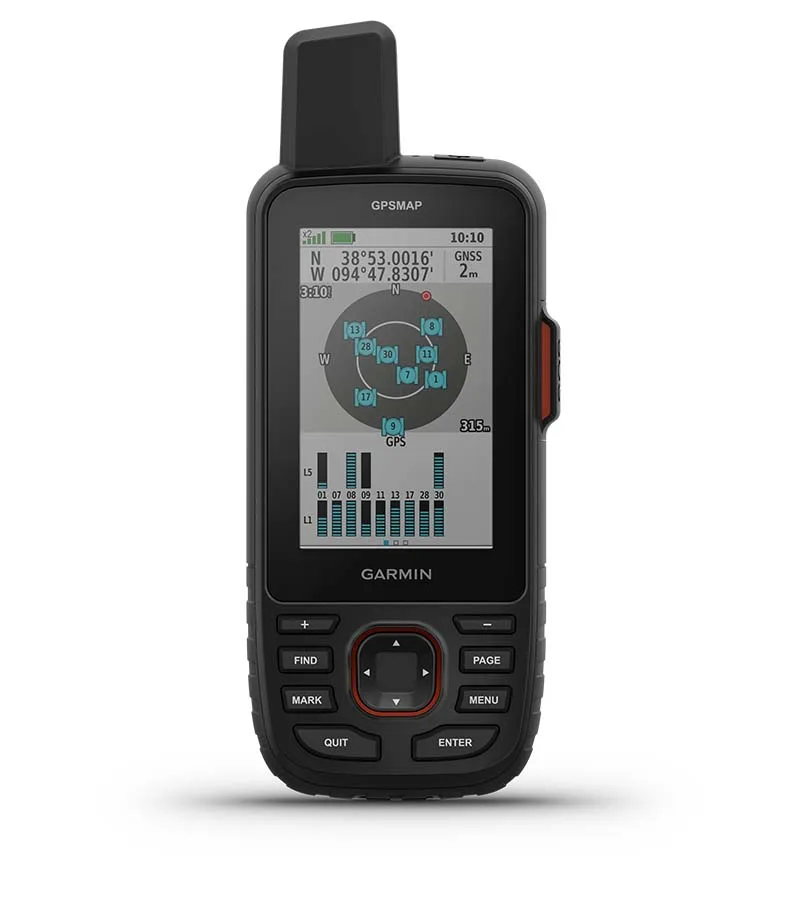
Track your position in challenging conditions with multi-band technology and expanded GNSS support. |
 |
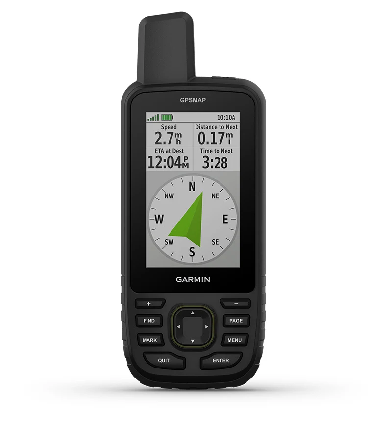
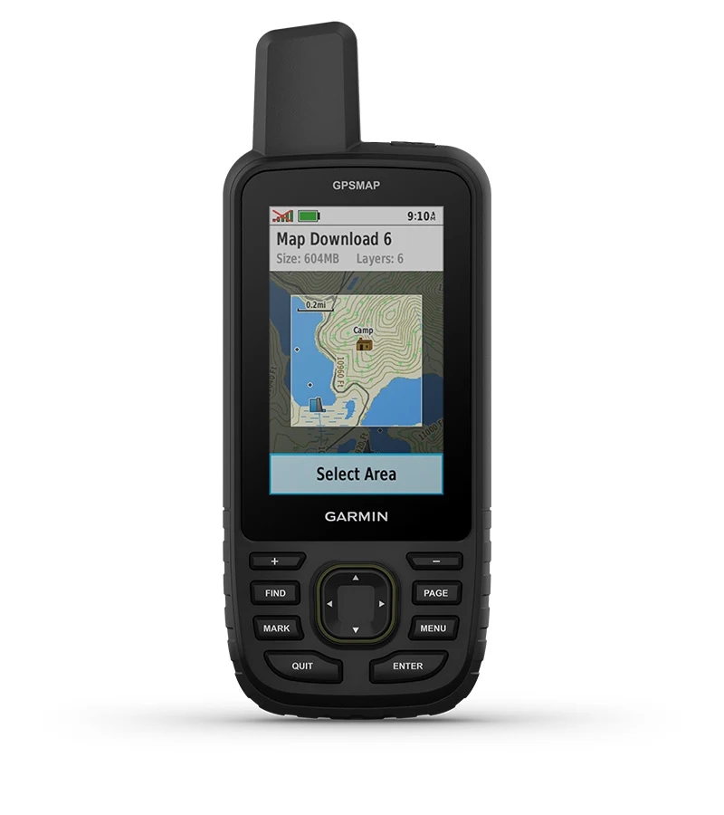
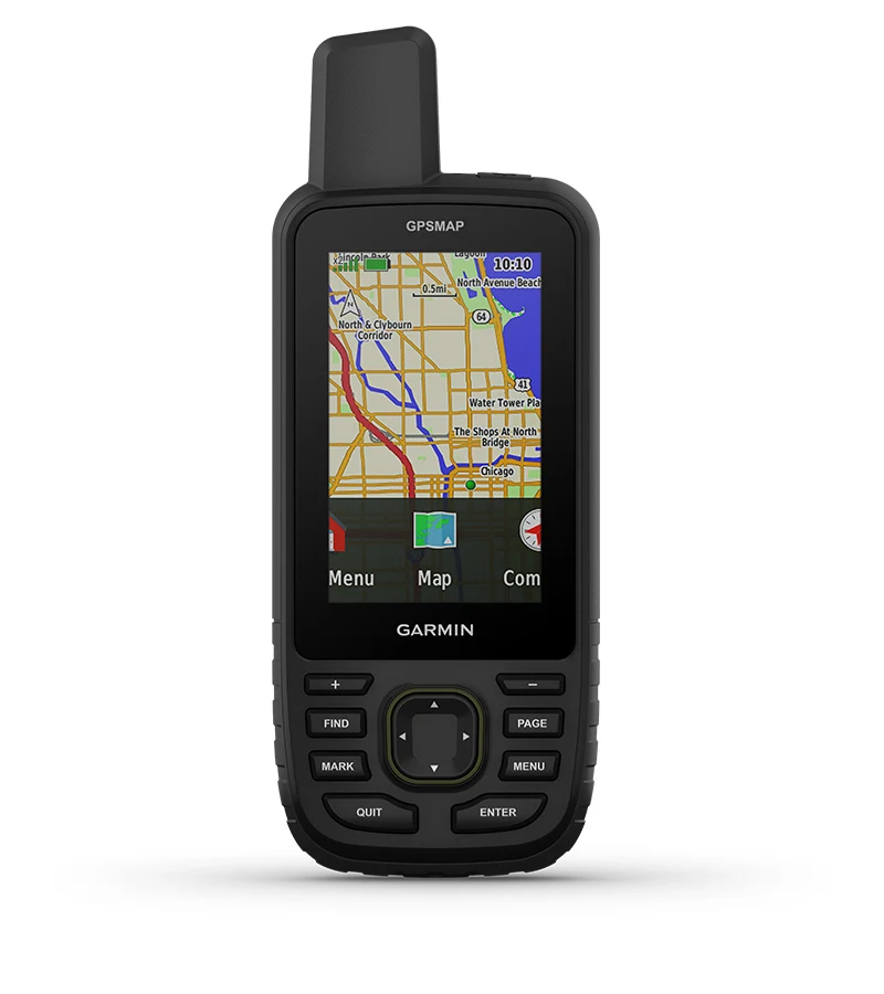
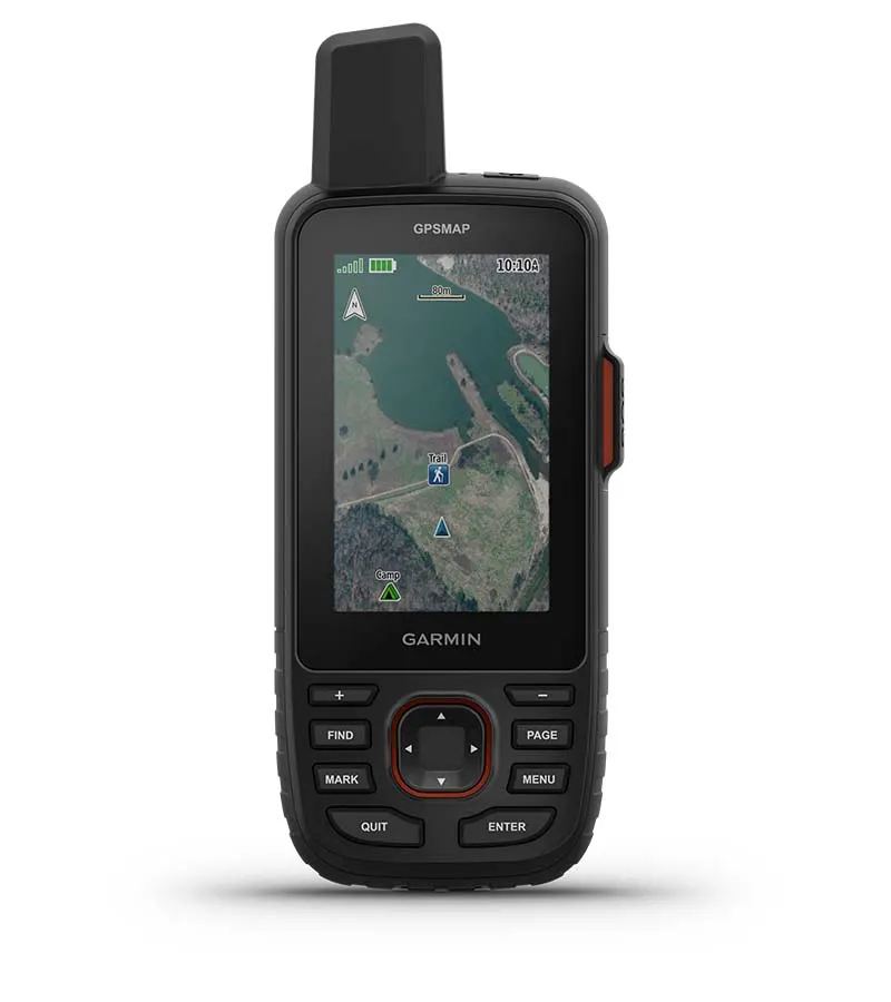
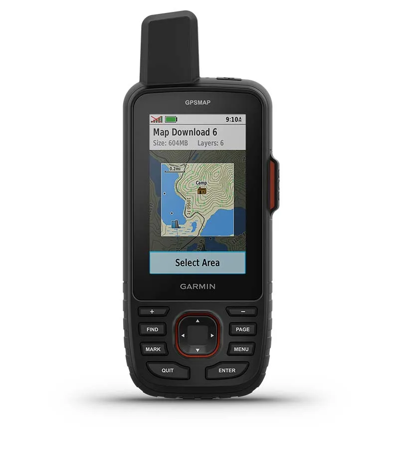
See the terrain you’ll travel with vivid satellite imagery that downloads right to your navigator. | |
 |
Stay tuned to the forecast with active weather on your route when paired to your compatible smartphone. |
 Multi-Band GNSS Support |
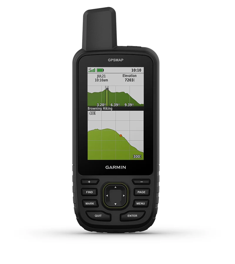
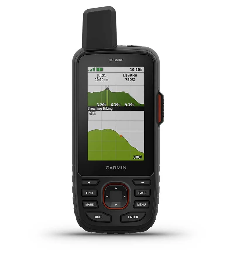
 ABC Sensors |
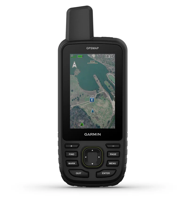 Satellite Imagery |
| Access multiple global navigation satellite systems (GPS, GLONASS, Galileo and QZSS). Get access to multiple frequencies sent by navigation satellites for improved position accuracy in areas where GNSS signals are reflected, weak or typically don't penetrate. | Navigate every trail with ABC sensors, including an altimeter for elevation data, barometer to monitor weather and 3-axis electronic compass. | Download high-resolution photorealistic maps directly to your device via Wi-Fi technology. Easily find trails, pick stand locations and parking, create waypoints and more. |
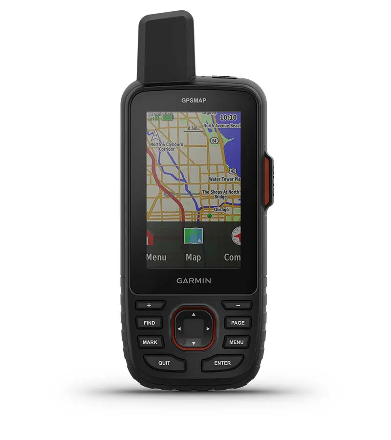
 Preloaded Topo Maps |
 Premium Map Features |
 Built for Adventure |
| Preloaded TopoActive maps show you terrain contours, topographic elevations, summits, parks, coastlines, rivers, lakes and geographical points. | With an Outdoor Maps+ subscription, you get public land information, landowner names, state plat maps, hunting management unit boundaries, BLM boundaries and more. | This handheld is built to military standards for thermal, shock and water performance (MIL-STD-810), and it’s even compatible with night vision goggles. |
 LED Flashlight |
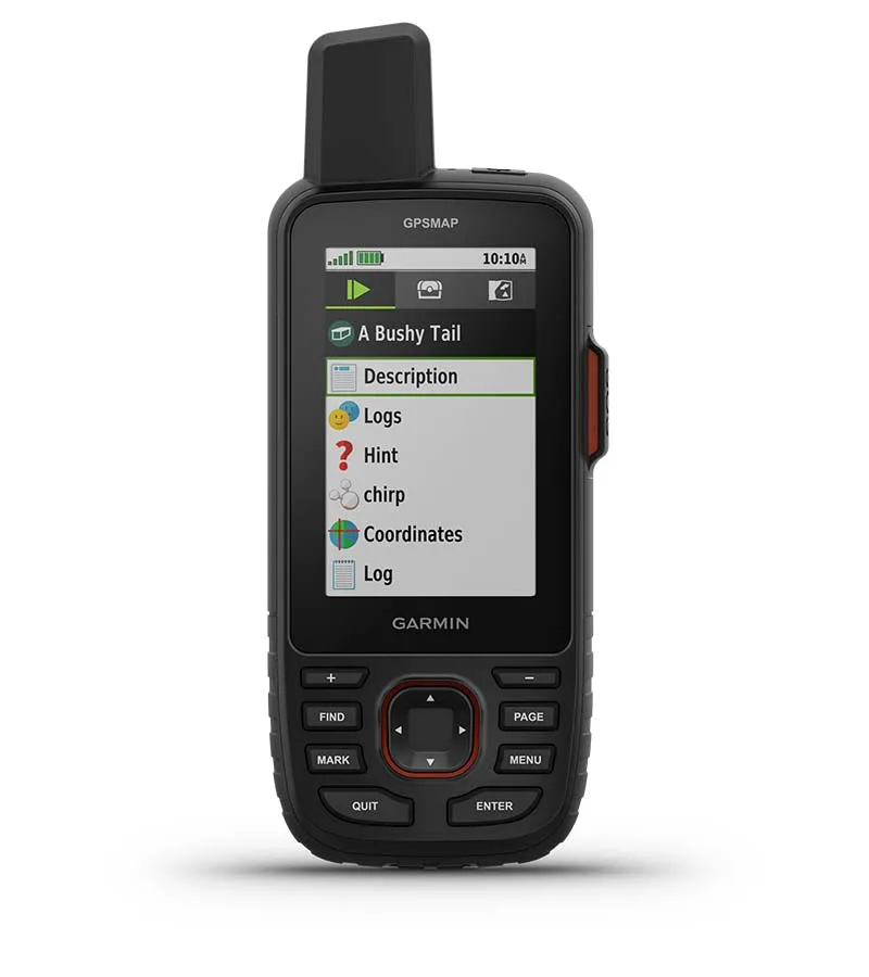
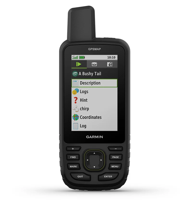 Geocaching |
 Battery Life |
| The GPSMAP 67 series helps you keep gear to a minimum with a built-in LED flashlight that can be used as a beacon to signal for help. | Get automatic cache updates from Geocaching Live, including descriptions, logs and hints. When connected via Wi-Fi technology or to the Garmin Explore smartphone app, each find will upload to your Geocaching.com profile. | The internal lithium-ion rechargeable battery provides up to 180 hours of battery life in GPS mode and up to 840 hours in expedition mode. |
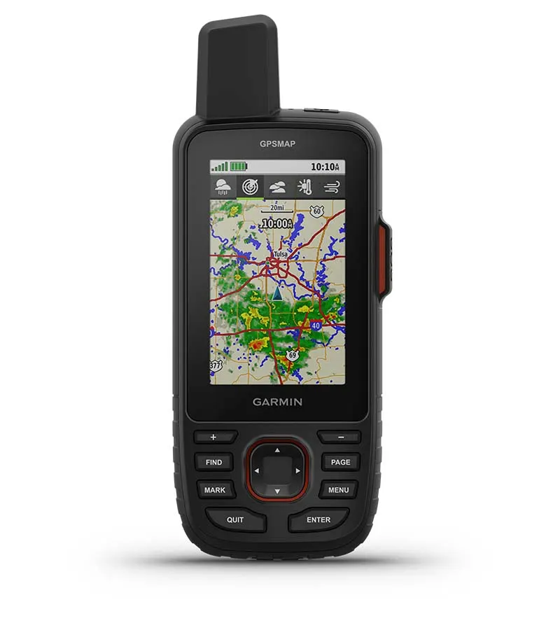
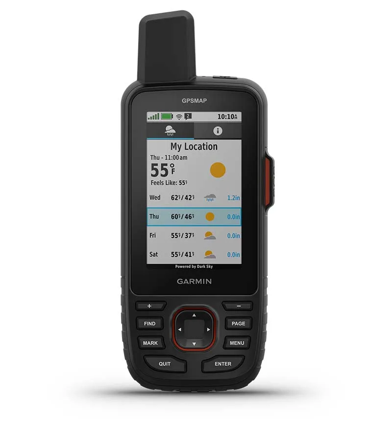
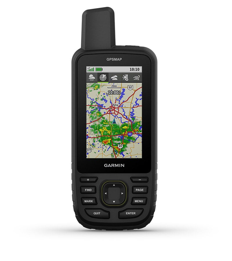 Active Weather |
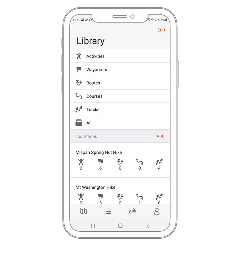 Garmin Explore App |
|
| When connected to the Garmin Explore smartphone app, you can get real-time forecast information, so you’re aware of the changing conditions. | Sync your user data with the Garmin Explore app and website. You can even review completed activities while still in the field. |
|
|
Travel longer with up to 165 hours of battery life in tracking mode and up to 425 hours in expedition mode. |
 |
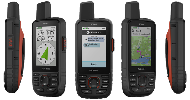
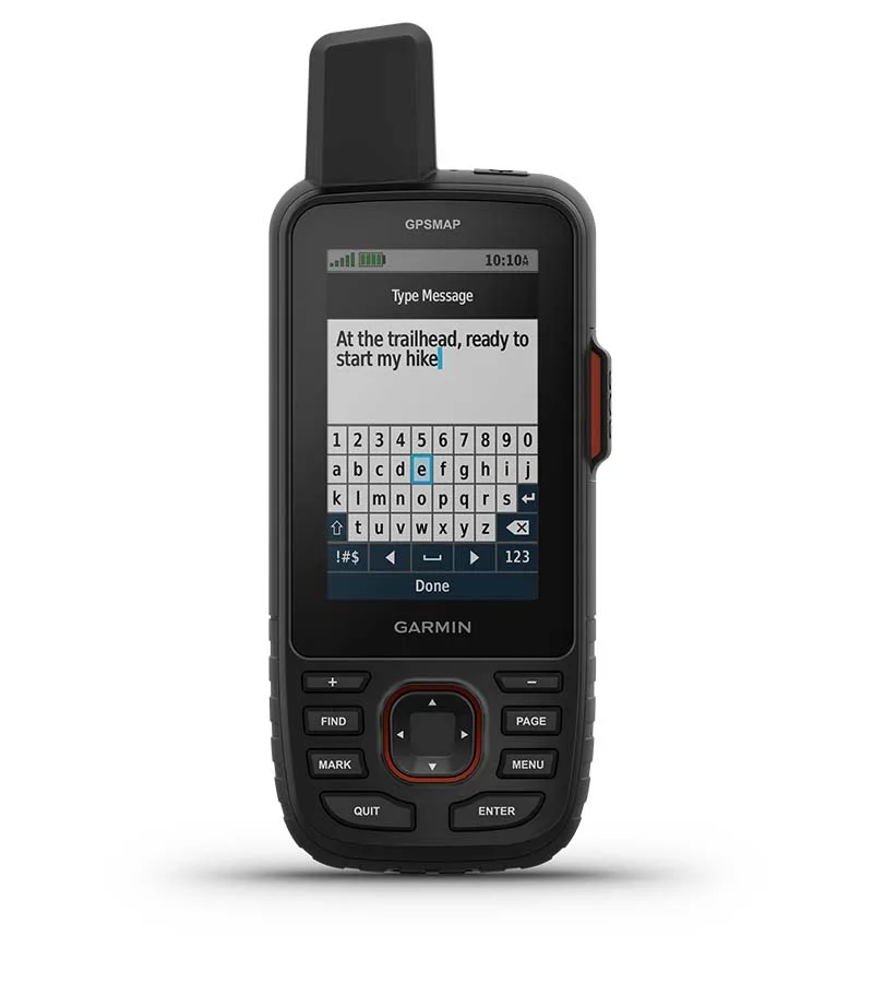
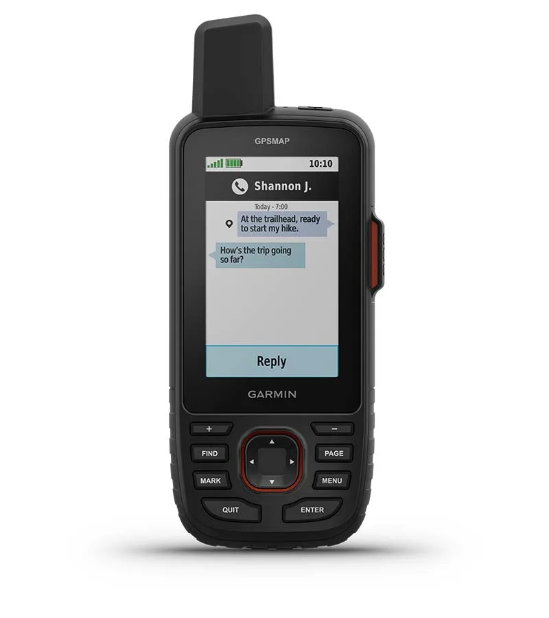
Two-way messaging lets you share the moment with the ones who matter. | |
|
|
Let your loved ones follow your adventure with location tracking. |
 |
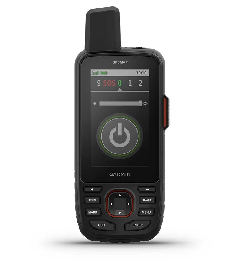
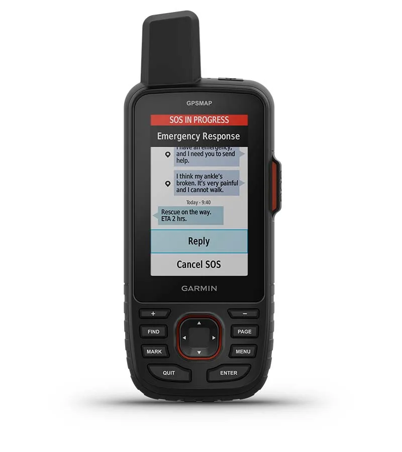
Have an emergency? Trigger an interactive SOS alert anytime, globally. | |
|
|
Track your position in challenging conditions with multi-band technology and expanded GNSS support. |
 Multi-Band GNSS Support |
 ABC Sensors |
 Satellite Imagery |
| Access multiple global navigation satellite systems (GPS, Galileo and QZSS). Get access to multiple frequencies sent by navigation satellites for improved position accuracy in areas where GNSS signals are reflected, weak or typically don't penetrate. | Navigate every trail with ABC sensors, including an altimeter for elevation data, barometer to monitor weather and 3-axis electronic compass. | Download high-resolution photorealistic maps directly to your device via Wi-Fi technology. Easily find trails, pick stand locations and parking, create waypoints and more. |
 Preloaded Topo Maps |
 Premium Map Features |
 Built for Adventure |
| Preloaded TopoActive maps show you terrain contours, topographic elevations, summits, parks, coastlines, rivers, lakes and geographical points. | With an Outdoor Maps+ subscription, you get public land information, landowner names, state plat maps, hunting management unit boundaries, BLM boundaries and more. | This handheld is built to military standards for thermal, shock and water performance (MIL-STD-810), and it’s even compatible with night vision goggles. |
 LED Flashlight |
 Geocaching |
 Battery Life |
| The GPSMAP 67 series helps you keep gear to a minimum with a built-in LED flashlight that can be used as a beacon to signal for help. | Get automatic cache updates from Geocaching Live, including descriptions, logs and hints. When connected via Wi-Fi technology or to the Garmin Explore smartphone app, each find will upload to your Geocaching.com profile. | Turn on expedition mode, and get up to 425 hours of battery life while using inReach technology. In the default tracking mode, you get up to 165 hours of battery life, and your device will save your location every 10 minutes. |
 Active Weather |
 Optional inReach Weather |
 Global Iridium Satellite Network |
| When connected to the Garmin Explore smartphone app, you can get real-time forecast information, so you’re aware of the changing conditions. | Use inReach connectivity to get detailed weather updates on the GPSMAP 67i handheld. Request weather forecasts for your current location, waypoints or destinations on your route. | Instead of relying on cellphone coverage, the GPSMAP 67i transfers your messages, SOS alerts and tracking via the global Iridium satellite network. |
 Two-Way Messaging |
Location Sharing |
 Interactive SOS Alerts |
| Exchange text messages with loved ones, post to social media, or communicate from inReach to inReach in the field. | Track your location and share it with those at home or out in the field. They’ll be able to see your progress or ping your device for your GPS location and more. | In case of emergency, trigger an interactive SOS message to the Garmin Response center, a 24/7-staffed professional emergency response coordination center. |
|
Garmin Explore App |
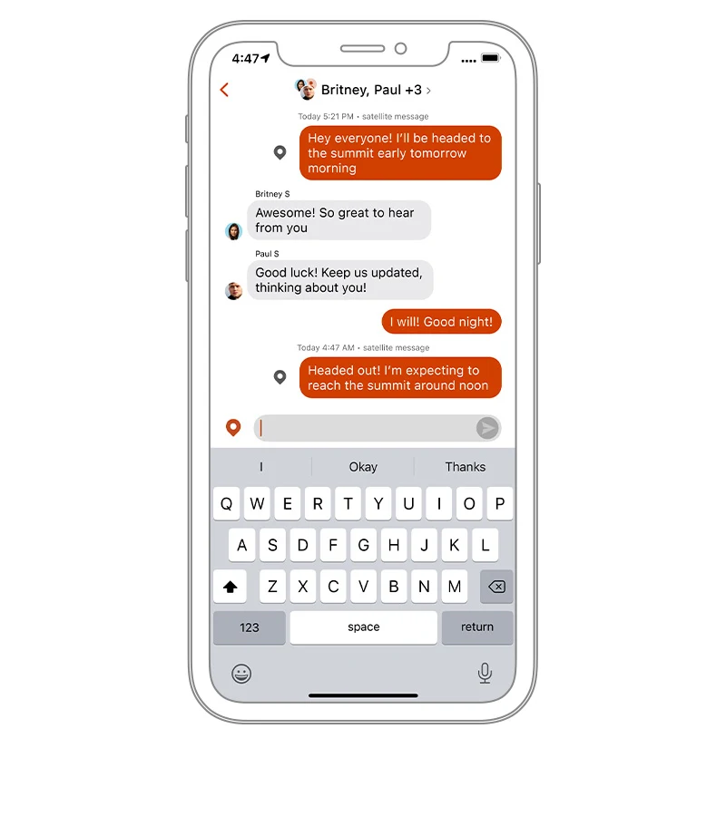 Garmin Messenger App |
|
| Plan, review and sync waypoints, routes and tracks by using the Garmin Explore app and website. You can even review completed activities while still in the field. | Download the Garmin Messenger app to your compatible smartphone, and pair it with your GPSMAP 67i handheld for fast, easy messaging and 24/7 SOS that’s not limited to cellphone coverage areas1. The app supports group messaging as well. |