 |
|
|
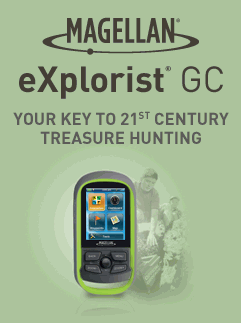
eXplorist GC is built for a premium geocaching experience.
Whether you're a seasoned geocacher with more than a thousand
finds or a newbie that's interested in getting in on the action,
eXplorist GC provides all the tricks of the trade. Probably most important, eXplorist GC supports paperless geocaching, which allows you to download more than 20 unique characteristics of each cache, including name, location, description, hider, size, difficulty, terrain, hint, spoilers, attributes, and last 20 user logs among a number of other details. |
||
|
eXplorist GC comes with the most popular
geocaches pre-loaded to provide a unique out of box experience.
You can literally "turn it on and go!" To customize your geocaching experience with caches that meet your specific criteria, the eXplorist GC has seamless connection to geocaching.com. This allows you to search more than one millions caches worldwide. With a click of the mouse, you can transfer the information with the Send to GPS feature. Additionally, with a Premium Membership to geocaching.com, you can create custom Pocket Queries and update your device with fresh cache information easily on a weekly basis. Did we mention that eXplorist GC comes with a free 30 day pass to geocaching.com premium member services? Yes it does! Get access to full GPX file downloads, pocket queries, member only caches, and a host of other great features. Now that you're hooked up with a premium membership to geocaching.com, download thousands of geocaches to the eXplorist GC. The device can hold up to 10,000 geocaches so you can continue to load new caches for each and every new adventure. Searching for the right cache is easy by setting your search preferences: by nearest, by name, by type, by date, or by geocache ID. Also, you can customize your cache list. For example, show all regular size, traditional type caches that have not been found. |
|
|
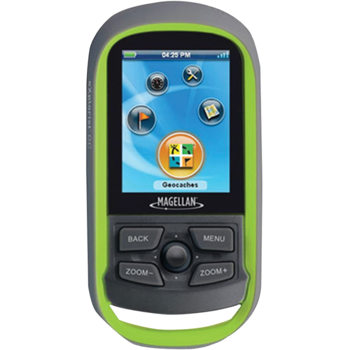
To support all your
geocaching adventures, the eXplorist GC comes packed with tons
of helpful hardware features. Most striking, the vibrant color
screen is transflective, which allows for the best readability
in direct sunlight. To zero in on the exact location of a hidden
cache, the SiRFstar III GPS chipset provides accuracy of 10-feet
(3-meters). To keep your fun going all day long, the device is
powered by two AA batteries for 18 hours of constant usage.
Finally, to keep your new favorite toy safe as you explore the
outdoors, eXplorist GC is rugged, waterproof, and submersible
(IPX-7). All of this is packed into a small and attractive
handheld form factor that can be hung around your neck or
attached to your pack with the built-in carabineer hook. eXplorist GC provides unmatched assistance with navigation, such as the combination of the world's two most useful navigational tools - a compass and a map! Overlay a series of different transparent compass styles on top of a pre-loaded worldwide map that show roads, water features, parks, and city centers. Access the dashboard screen that shows a mini-compass for quick reference and customizable navigation data fields, such as latitude, longitude, heading, bearing, distance to end, trip odometer, and many more. Go back to the map screen and view your active track, which is a series of digital breadcrumbs to record all yours movements. Mark your starting point (car, trailhead, parking lot...) with a waypoint and easily navigate back to that location once you've unearthed your fill of caches. eXplorist GC will not only find hidden treasure, but it will also help you find your way back. Compete with your friends with the unique geocache tracking features. The "time to find" cache feature records the time is takes to find each cache. eXplorist GC will keep a record of the time it takes to find each cache in the geocache details page and average all finds in your user profile. The device also tracks the number and type of geocaches found. Keep track of your finds on the geocache awards screen and stats page. Reference your Trip Summary to keep track of your distance travelled, complete travel time, moving time and stopped time, and average time to find. Easily reset your Trip Summary statistics to track the details of your next geocaching adventure. Whether you are searching for treasure in the Nordics, the Orient, or in the West Indies, eXplorist GC will provide accurate GPS signals thanks to the Satellite Based Augmentation Systems (SBAS) of WAAS, EGNOS, and MSAS, which is identified in the GPS status bar. eXplorist GC also displays coordinates in a myriad of different global systems, including UTM and WGS84. Geocaching is a worldwide phenomenon and eXplorist GC will help guide you accurately to treasures all over the globe. eXplorist GC has the ease-of-use to help a novice geocacher discover the world of high-tech treasure hunting and the sophistication to keep an experienced hunter satisfied with loads of advanced features. "X" marks the spot and eXplorist GC can help to find it! |
||
Free 30 Day Premium Membership to Geocaching.com - Download GPX files, create your own Pocket Queries, and get tons of other premium membership features.
Pre-Loaded with the Most Popular Geocaches - These caches have been found more than any others! Get a complete out-of-the-box experience by searching and finding the top geocaches in your region!
Paperless Geocaching - Download and view more than 20 unique characteristics of each cache and view, search, filter on the device. Details include name, location, description, hider, size, difficulty, terrain, hint, spoilers, and last 20 user logs among a number of other details.
Easy to Navigate Menus and Rich Graphics - A dedicated device means there is no nonsense to by-pass to get to your geocaches. A simply main menu, intuitive contextual menus, and vibrant graphics make this device easy to use.
Brilliant, sunlight readable color screen - A vibrant 2.2" color transflective screen provides the best readability in direct sunlight.
Store up to 10,000 geocaches on the device - That is a total of 20 Pocket Queries! Load a new GPX file for each trip or all the locations you love to geocache so you'll have data on board when you need it.
Geocache Awards - Keep track of all your finds and receive special awards based on number of finds, types of finds, and other interesting combinations of actions. The more you find, the more you are rewarded!
Rugged and waterproof to IPX7 - Focus on the adventure not protecting the device.
High-sensitivity SiRFstar III GPS with 3-5 meter accuracy - Most smart phones provide 20-30 meter GPS accuracy, which will get you close to the geocaching, but will it really help your find it? 3-5 meter GPS accuracy will put you on top of the cache and make the find that much easier.
Picture Viewer - Transfer images within geocache descriptions and view in the field to help locate difficult to find geocaches.
Pre-loaded Worldwide Map - Referencing a complete road network in North America and Western Europe and major roads throughout the rest of the populated world to help in orientation. See parks, rivers, lakes, major city points, and other types of land use along side your target geocaches.
18 Hours of battery life using 2 AA batteries - Go strong for an entire day (or more) of geocaching. No stopping to replace the batteries.
Suspend Mode - The goal is to conserve battery life by putting the device into an advanced power saving mode. Suspend mode will turn off everything expect for GPS tracking. Wake up the device with a single click.
On-board user memory - Loads on space to add up to 10,000 geocaches and tons of photos and personalized backgrounds.
Create and Store 500 Waypoints - Whether you mark your car, campsite, starting location, or places to re-visit, waypoints are a common and useful feature in all outdoor GPS devices.
Record Active Track and See "Breadcrumbs" on the Map Screen - Keep a log of all the steps you took throughout the day hunting for geocaches. Reference your track to find your way back to keep a record of geocaching adventures.
Trip Summary - Start your journey with one-click and keep tabs on useful statistics such as distance travelled, average speed, elevation gain and descent, and average time to find.
NMEA Message Output (USB Only) - For hardcore outdoor GPS enthusiasts who want to connect their device to laptop running VantagePoint software and see your position on computer screen.
Multiple Coordinates and Map Datums - Geocache around the world and do it accurately. See your geographic location in UTM coordinates or reference the OS Grid while hunting for caches in Great Britain.
- UI Improvement.
- Support Groundspeak Geocache Favorites.
- Allow to disable Awards & Merit Badges.
- Supports additional post-sale National Geographic and Digital Globe Maps.
- New Preloaded Map.
- Shaded Relief for Map.
- Allow enable/disable position-to-destination line with active Goto.
- Additional Language Support.
- Various bug fixes.
- Messages were added to the startup screen to notify the user of the current activity. The messages are:
- "Loading Track..."
- "Loading Geocaches..."
- "Loading Waypoints..."
- "Recovering Database..."
- "Indexing Database..."
- A maximum of 1000 files will be read and loaded from the device. Any additional files beyond the 1000 will not be loaded. A message notifying the user will be displayed. The message will be: "1000 .GPX files loaded. Please consolidate additional files."
- The priority of reading the files will be the following:
- Tracks
- Geocaches
- Waypoints
- NOTE: Maximum number of Geocaches is still 10,000.
- Modification of the database loading and rollback process to improve on the load time.
- Bad Nav Fields (related to bad positioning close to destination).
- Position averaging bug when placing geocaches.
- Smart Arrow slow down.
- Geocaching Improvements:
- Correlation between geocaches and associated child waypoints from either Geocache or Waypoint Lists.
- Display specific child waypoint icons from geocaching.com.
- Field Notes text file is now properly formatted for upload to geocaching.com.
- Improved UI when creating a new geocache.
- Ability to edit a geocache after creating, but before submitting to geocaching.com.
- Incorrect picture attachment tags have been removed from Preloaded Geocaches.
- "Not Found" counter has been corrected.
- Map Display Improvements:
- Options Menu will provide new function to locate nearest geocache that is "Not Found" and "Not Attempted".
- "Found" geocaches will display as smiley faces on the map.
- Ability to display only "Found" or "Not Found" geocaches on the map.
- Map detail will draw more quickly during zooming and panning.
- Accurate map scale when zooming and toggling back and forth between map and other screens.
- "Ground Zero" animation to provide visual cues in addition to audible cues when closing in on geocache location.
- Improved Map Screen:
- New images and icons.
- Smoother updating of the map while driving.
- Split TrueView is disabled when AutoTrueView is unchecked in Map Options.
- Exits without any POIs do not appear.
- Improved Auto Night view, with smooth day/night switching, adjusted brightness, more colors and ON by default.
- Improved vehicle position icon in 3D view.
- Navigational Data Improvements:
- Heading and bearing values are more accurate.
- Sun & Moon location corrected on the Compass Screen and Overlay.
- Trip Summary screen now working properly.
- Avg. Speed and Avg. Moving Speed has been corrected.
- Start Trip function now works properly.
- "Start Trip" will delete active track and any active routes.
- All items in "Trip Summary" will be reset.
- "Stop & Save" will stop the active trip recording, but not reset Trip Summary.
- The track will be saved on the device so it can be exported to PC at a later time.
- Activating new routes does not interfere with Trip Recording or Trip Summary.
- Other Improvements:
- Soft USB eject will not result in a reconnection to computer.
- Software optimization that will be noticed in general use of the product.
- Consistent use of preferred units of measurement (m/km or f/mi) throughout the user interface.
- Main Menu rotation is more intuitive using joystick.
- Improved order and function included in the Options Menu.
- Improved translation and language localization.
- Properly synchronize waypoint names to show the same name regardless of the source.