 |
|---|
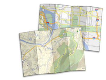
Garmin Mapping Software
- Several mapping software solutions have been made available by Garmin for interfacing with their GPSr devices:
- MapSource: Compatible with serial port Garmin GPSr models. Limited functionality with USB port GPSr models.
- BaseCamp: Compatible with USB port Garmin GPSr models. Limited functionality with serial port GPSr models.
- HomePort: Compatible with Garmin
GPSr models supporting BlueChart maps.
- Use Garmin BaseCamp with GPSMAP 62 series and newer, or MapSource with prior GPSMAP models.
- Current version download links can be found in Software.
- Tip: Read An Introduction to using Garmin GPSr with paper maps to learn how both can be used together.
Delivery Methods
Garmin maps are available in a variety of formats. They may be purchased on DVD, on a pre-programmed microSD card, or downloaded directly from the Garmin website. Many excellent non Garmin maps are also available online from multiple sources.- DVD/CD ROM: Maps purchased in this format will require a computer to use. The installation process will install the maps and BaseCamp application to your computer. BaseCamp can then be used to send maps to either your device or microSD card. Please note that most mapping products in this format are locked to a single device and they are non-transferable. City Navigator maps in this format can be updated by purchasing a map update, when available.
- microSD Card: Pre-programmed microSD cards are ready to use immediately out of the box. Simply unpack the card and insert into your compatible GPSr device. These maps are not locked to a specific device which allows you to move the card between multiple units as desired. BaseCamp can be used to view mapping detail on your computer from compatible pre-programmed microSD cards. City Navigator maps in this format are not eligible for map updates and mapping from the microSD card cannot be copied. To obtain updated content, a new card must be purchased.
- Download: Maps purchased in this format can be downloaded directly from the Garmin website. Downloaded maps can be sent to either your GPSr unit or microSD card. All maps in this format are locked to a specific device and they can only be used on the device that they were locked to. BaseCamp can be used to view downloaded mapping detail on your computer. City Navigator maps in this format are not eligible for map updates. If you wish to obtain updated content, a new download will need to be purchased.
- Outdoor Maps+: Download a wide variety of Garmin mapping content directly to your compatible Wi-Fi enabled device. Your one year subscription can be transferred from one Garmin device to another and provides full access to frequently updated premium Garmin map products.
Map Types
Garmin GPSMAP support for the following map formats varies by model:- IMG (*.img) Proprietary Garmin vector map
- KMZ (*.kmz) User created raster map (not locked to device)
- JNX (*.jnx) Garmin BirdsEye high resolution satellite raster map imagery (locked to specific device)
- FIT (*.fit) Flexible and Interoperable data Transfer files save date, time, distance, calories, speed, ascent, descent and other data
- GPX (*.gpx) GPs eXchange format is a universal open source XML data format used for waypoints, routes, and tracks
- GPI (*.gpi) Garmin Points of Interest (POI) files provide location and other information for popular destinations
Map Names
Common *.img map names used by Garmin. Do not use these file names when saving your maps. See Garmin Vector Map ID for more examples.- gmapprom.img | Primary or Pre Installed Map
- gmapprom1.img | Secondary Map
- gmapprom2.img | Additional Map
- gmapbmap.img | Device Base Map
- gmapoem.img | OEM Installed Map (can not be disabled in Map Settings)
- gmapsupp.img | Map written to device or microSD card by MapSource
- gmaptz.img | Time Zone Map
- gmap3d.img | Primary 3D Buildings Map
- gmap3d1.img | Secondary 3D Buildings Map
Map Storage Capacity
Your Garmin GPSr is not without limitation. Consider these limits when selecting maps for your GPSMAP:| GPSMAP | 60 | 60C/CS/CSx | 76/S | 76C/CS/Cx/CSx | 62/78 | 64/65 | 66/67/86 | 79 | H1 | 276Cx | |
| IMG | Segments | 2,025 | 2,025 | 2,025 | 2,025 | 3,000 | 3,000 | 15,000 | 15,000 | 15,000 | 15,000 |
| KMZ | Tiles (JPEG) | - | - | - | - | 100 | 500 | 500 | 500 | 500 | 500 |
| JNX | Files | - | - | - | - | 250 | 250 | 250 | 250 | 250 | 250 |
| FIT | Files | - | - | - | - | - | - | - | - | ∞ | - |
| Waypoints | - | - | - | - | - | - | - | - | ∞ | - | |
| Courses | - | - | - | - | - | - | 250 | - | ∞ | - | |
| Points per Course | - | - | - | - | - | - | 200 | - | ∞ | - | |
| Activities | - | - | - | - | - | - | 300 | 300 | ∞ | - | |
| Points per Activity | - | - | - | - | - | - | - | - | ∞ | - | |
| Active Tracklog | - | - | - | - | - | - | - | - | ∞ | - | |
| GPX | Files (GPX + GGZ) | - | - | - | - | 2,000 | 2,000 | 2,000 | 2,000 | 2,000 | 2,000 |
| Waypoints | 500 | 1,000 | 1,000 | 1,000 | 2,000 | 5,000 | 10,000 | 10,000 | - | 10,000 | |
| Geocaches | - | - | - | - | 5,000 | 5,000 | 5,000 | 5,000 | 12,000 | - | |
| Routes | 50 | 50 | 50 | 50 | 200 | 200 | 250 | 250 | - | 250 | |
| Points per Route | 250 | 250 | 50 | 250 | 250 | 250 | 250 | 250 | - | 250 | |
| Saved Tracks | 20 | 20 | 10 | 20 | 200 | 200 | 250 | 250 | - | 250 | |
| Points per Track | 500 | 500 | 750 | 10,000 | 10,000 | 10,000 | 20,000 | 20,000 | - | 20,000 | |
| Archived Tracks | - | - | - | - | 2,000 | 2,000 | 2,000 | 2,000 | - | 2,000 | |
| Active Tracklog | 10,000 | 10,000 | 10,000 | 10,000 | 10,000 | 10,000 | 20,000 | 20,000 | - | 20,000 | |
| GGZ | Files (GPX + GGZ) | - | - | - | - | - | 2,000 | 2,000 | 2,000 | 2,000 | - |
| Geocaches | - | - | - | - | - | ∞ | ∞ | ∞ | ∞ | - | |
| GPI | Files | - | - | - | - | 20 | 20 | 20 | 20 | 20 | 20 |
| POI | - | - | - | - | ∞ | ∞ | ∞ | ∞ | ∞ | ∞ | |
Map Install Direct
Not all maps require installation to a host computer before being sent to your Garmin GPSr. Maps in the following formats can be copied directly to a compatible GPSMAP GPSr or microSD card as shown:- IMG: [GPSr]\Garmin\ or [microSD]\Garmin\
- KMZ: [GPSr]\Garmin\CustomMaps\ or [microSD]\Garmin\CustomMaps\
- JNX: [GPSr]\Garmin\BirdsEye\ or [microSD]\Garmin\BirdsEye\
- FIT: [GPSr]\Garmin\Activities\ or [GPSr]\Garmin\Courses\
- GPX: [GPSr]\Garmin\GPX\ or [microSD]\Garmin\GPX\
- GPI: [GPSr]\Garmin\POI\ or [microSD]\Garmin\POI\
Map Install PC
Locate a Garmin supported format map you wish to use with your compatible GPSMAP GPSr and download the Windows version to your computer.Install Map to PC
- If the downloaded map file is a *.zip archive, you must unzip the file to extract the *.exe map installer
- Close any open mapping software programs (Map Source, BaseCamp, etc.)
- Run the *.exe map installer
- When prompted, choose map installation options as desired
- For best results, do not change the default map installation directory
- Allow the installer to complete the map installation
- Exit the installer
- Open BaseCamp and select the newly installed map from the drop down menu to confirm availability
► Send Map to GPSr with MapInstall
► Send Map to GPSr with BaseCamp
► Send Map to GPSr with Mapsource
Map Install Mac
Locate a Garmin supported format map you wish to use with your compatible GPSMAP GPSr and download the Mac version to your computer.Install Map to Mac
- If the downloaded map file is not in *.gmapi format, double click the file to launch your default archive utility and extract the map from the compressed archive
- Double click the *.gmapi map file, invoking Garmin MapManager
- The selected map will be displayed under "Install these map(s)?"
- Select "Install", and then "Close" after installation is completed
- MapManager will display a list of all Garmin compatible maps installed on your computer
- Close MapManager
- Open BaseCamp and select your new map from the map menu to confirm installation
► Send Map to GPSr with MapInstall
Garmin Custom Maps
Already have a paper map you want to use with your Garmin GPSMAP? Perhaps you have downloaded a local or state park map in PDF format and wish you could somehow get it into your GPSMAP? Converting paper or digital maps into custom maps you can use with your Garmin GPSMAP has never been easier!► Garmin Custom Maps Tutorial
Garmin BirdsEye Maps
Annual subscription based service providing unlimited access to Garmin satellite imagery and/or detailed USGS/NRC topographic raster maps for use with your Garmin GPSMAP and BaseCamp.BirdsEye Satellite
- Transfer an unlimited number of satellite and aerial image segments to your device with free BaseCamp software.
- High-resolution sub-meter color satellite imagery captures the world in brilliant clarity and detail.
- Allows you to layer the Garmin vector maps on your handheld (such as TOPO 100K, TOPO 24K or City Navigator®) with BirdsEye Satellite Imagery for a real-life view of roads, buildings and terrain.
- Makes it easy for hunters to perform preseason scouting, determine placement of stands and locate game pinchpoints.
- Helps hikers and campers find trails/trailheads and clearings for camping areas.
- Enables geocachers to determine the terrain type around a cache and identify parking areas close to the caches.
- Allows travelers to view tourist hot spots and landmarks from an aerial view to make excursions memorable without getting lost
BirdsEye TOPO
- Provides highly detailed 1:24,000* scale raster USGS maps and 1:50,000 scale raster NRC maps.
- Features an unlimited amount of downloadable raster maps for 1 year using BaseCamp software.
- Layer Garmin vector maps (TOPO 100K, TOPO 24K, City Navigator) on your GPSMAP for a 'birds eye' view of roads, buildings and terrain.
- Displays parking and camping areas, trails, points of interest, water sources and more.
BirdsEye Select
- Highly detailed (1:25,000 or 1:50,000) raster map imagery
- Coverage for Germany, France, Great Britain, Ireland, Austria, Italy and Switzerland
- Each single purchase allows you to select and purchase custom sections (a set amount of square kilometers per region) of BirdsEye Select raster imagery for transfer to your Garmin handheld device.
► Garmin BirdsEye Tutorial
Garmin POI
While many *.img maps will include unique POI
destinations, each individual user may wish to have access to more specific
additional POI destinations. - All Garmin GPSr are limited to a relatively small number of waypoint destinations, but most can index an unlimited number of POI destinations.
- Pre-compiled POI files may include restaurants, safety camera locations, fuel stations, or other favorite tourist destinations.
- User created Custom POI files can include any unique information the user deems useful.
► Garmin POI Tutorial
Maps 4 Garmin GPSr