
BirdsEye Direct Satellite Imagery
Note: Firmware update 14.80 moved BirdsEye Direct
satellite imagery downloads to
Map Manager >
Outdoor Maps+
- The Montana 7x0 provides access to BirdsEye Satellite Imagery via direct-to-device downloads.
- Transfer an unlimited number of satellite and aerial image segments to your device.
- High-resolution sub-meter color satellite imagery captures the world in brilliant clarity and detail.
- Layer Garmin vector maps with BirdsEye Satellite Imagery for a real-life view of roads, buildings and terrain.
- Makes it easy for hunters to perform preseason scouting, determine placement of stands and locate game pinchpoints.
- Helps hikers and campers find trails/trailheads and clearings for camping areas.
- Enables geocachers to determine the terrain type around a cache and identify nearby parking areas.
- Allows users to view tourist hot spots and landmarks from an aerial view to make excursions memorable without getting lost.
- Coverage and level of detail will vary by location.
- Heavily populated areas are updated more frequently, usually on an annual basis.
- Lesser populated areas are updated less frequently, usually on a biennial basis for most regions.
- Existing BirdsEye satellite maps must be re-downloaded to display updated satellite imagery.
- BirdsEye map issues should be reported here.
- BirdsEye Satellite was upgraded to provide clearer and more vivid imagery in February 2020.
- BirdsEye Direct satellite imagery can not be displayed in BaseCamp.
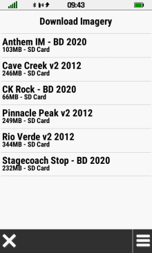
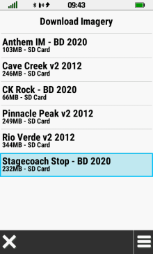
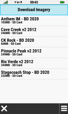
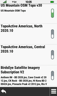
BirdsEye Direct Menu
 |
 |
 |
|
|---|---|---|---|
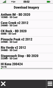
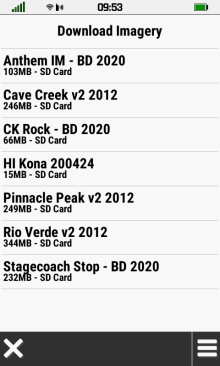
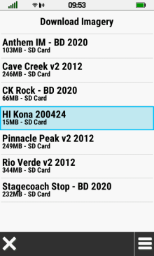
| BirdsEye Direct map list | Select
desired map to open map option menu |
Select
[Download Imagery] to create new BirdsEye Direct map |
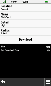
Create BirdsEye Direct Map
- Requires active Wi-Fi internet connection.
- The Montana 7x0 can be used normally after download begins (satellite imagery will continue to download in background).
- Map Size and Estimated Download Time will vary with Location, Detail and Radius selections.
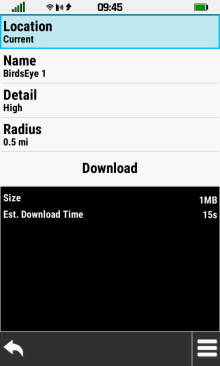
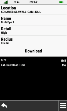
Edit Map Location
 |
 |
 |
 |
|---|---|---|---|
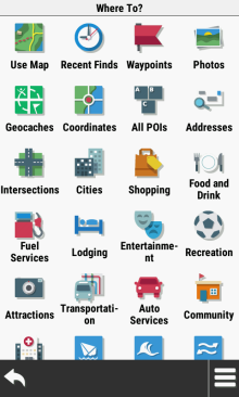
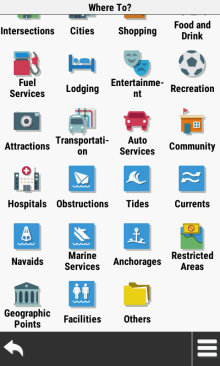
| Use current location | Change location | Choose from available location categories | |
Edit Map Name
 |
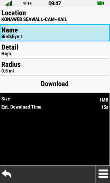 |
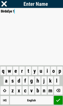 |
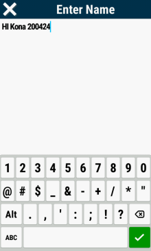 |
|---|---|---|---|
| Use default map name | Change map name | Edit map name |
|
Edit Map Detail
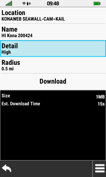 |
 |
 |
 |
|---|---|---|---|
| Select [Detail] | Choose [Standard] for lowest resolution |
Choose [High] for medium resolution |
Choose [Highest] for maximum resolution |
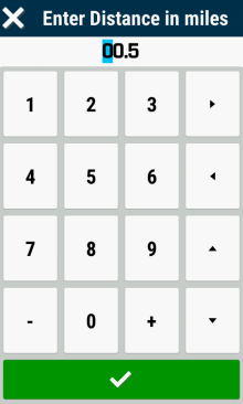
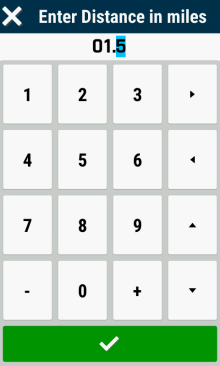
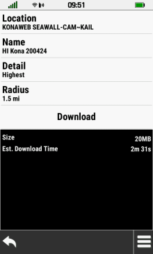
Edit Map Radius
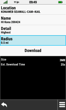 |
 |
 |
 |
|---|---|---|---|
| Select [Radius] | Edit Radius value |
|
Map Size & Download Time reflect changes made |
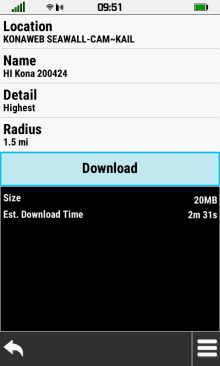
Download Map
 |
 |
 |
 |
|---|---|---|---|
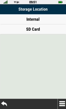
| Select [Download] | Choose map storage location | Map download in progress | Map download completed |
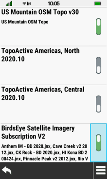
Map Options
 |
 |
 |
 |
|---|---|---|---|
| Select desired map | Select [View Map] to View Imagery |
Select [Rename] to Edit Map Name |
Select [Delete] to remove map |
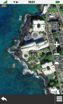
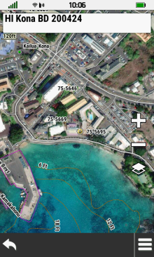
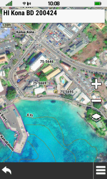
View Map
 |
 |
 |
 |
|---|---|---|---|
| Map overview is displayed | Use + / - to zoom in/out | Pan map to explore details | |
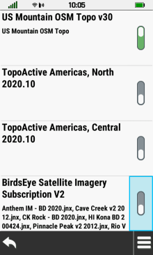
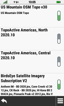
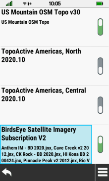
Enable BirdsEye Imagery
- Open [Setup > Map > Configure Maps]
 |
 |
 |
 |
|---|---|---|---|
| Select toggle to quickly enable with most recent brightness level |
Select BirdsEye title to open map configuration menu |
Select desired map brightness | BirdsEye maps are enabled |
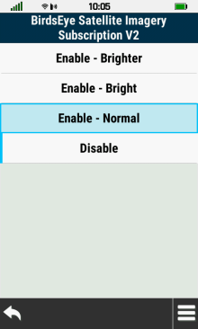
Map Brightness
 |
 |
 |
|
|---|---|---|---|
| Normal | Bright | Brighter |
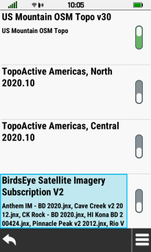
Disable BirdsEye Imagery
- Open [Setup > Map > Configure Maps]
 |
 |
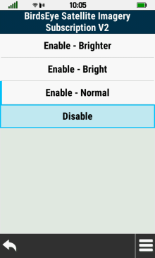 |
 |
|---|---|---|---|
| Select toggle to quickly disable | Select BirdsEye title to open map configuration menu |
Select [Disable] | BirdsEye maps are disabled |